On Tuesday, August 30th, we climbed Katahdin Mtn, the northern terminus of the Appalachian Trail. We started early and were the second hikers to summit that day, so we had time to ourselves to get shots at the summit sign. Then 12 other thru-hikers came up, and we had quite a party at the summit.
After exactly 5 months and 2,181 miles, our epic hike is at an end!

A shuttle drops hikers off at Abol Bridge to enter the Park and resume our hike

The entrance sign for Baxter State Park

Crossing a flooded area on the trail. We had to take a high water detour at one point, since we couldn't cross the river on the regular route.

Little Niagara Falls on Nesowadnehunk Stream

Rushing rivers after the rainfall from Hurricane Irene

Finally, the summit of Katahdin is visible!

Camping at the Birches, which is reserved for thru-hikers. It was dark, swampy and uneven - nothing but the best for thru-hikers!

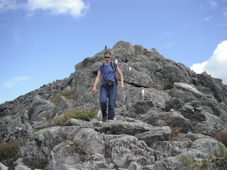
It was a tough 5 mile climb up Katahdin, with lots of rock scrambles
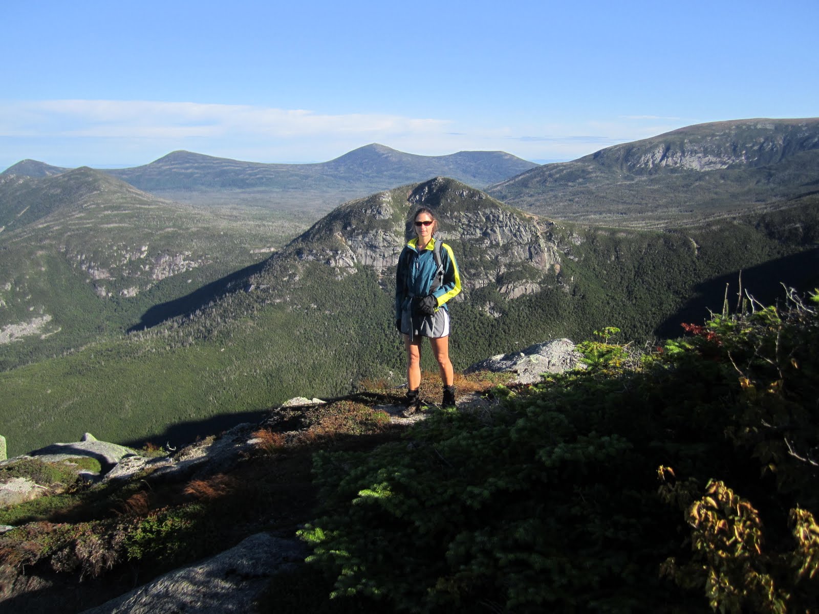
Range of mountain views, early morning on the trail up Katahdin

The Tableland, a flat rocky section below the summit of Katahdin
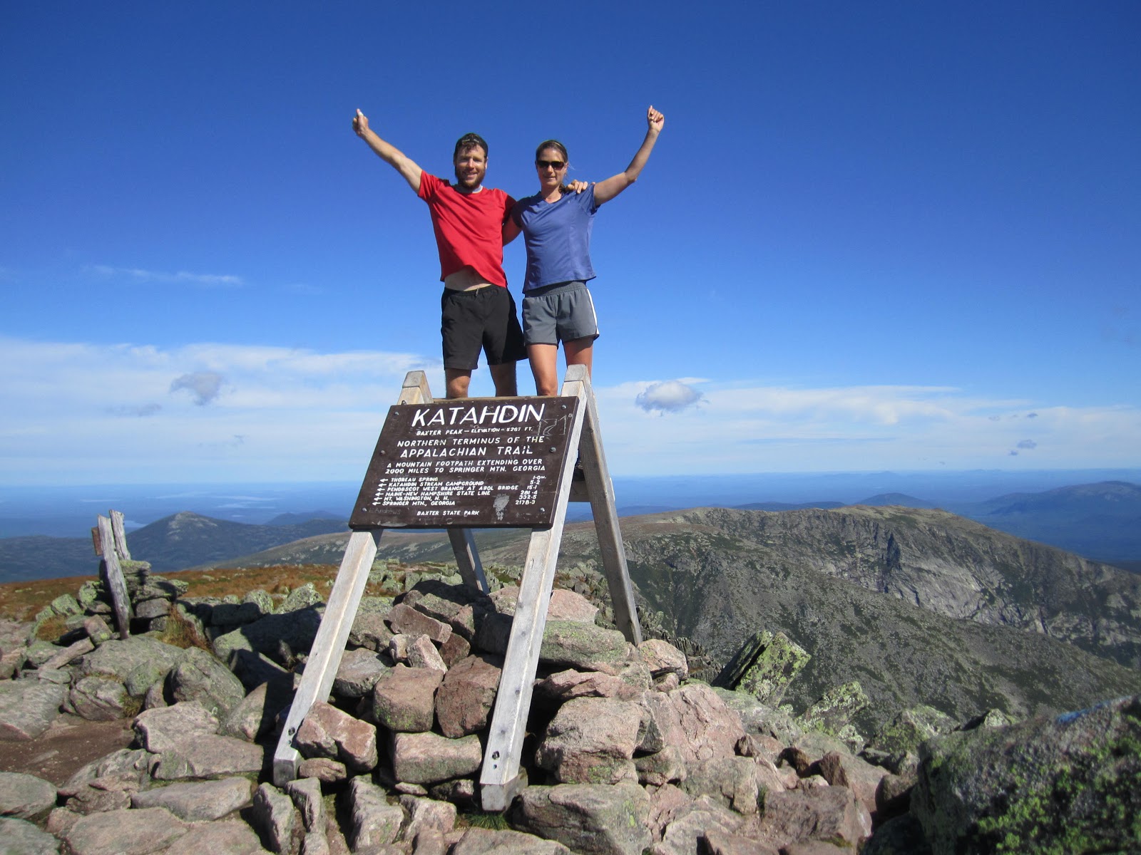
 The summit sign marking the end of the AT. Katahdin is 5,268 feet - almost exactly one mile high.
 We did it!
 We have now officially thru-hiked the Appalachian Trail
 A fellow thru-hiker, Portrait, got us started on jumping shots.
 Y-Knot gets good height, but sprains an ankle on the landing
No one jumped as high as Portrait, who did a dozen jumps and was fine.
 Displaying our summit sign, which Mike made back in NH.
 Thru-hikers throng the summit
 The Runaways - Goldilocks and Havok, 15 and 13, probably the youngest hikers this season. They hiked by themselves, with visits from their parents along the way.
 Party at the summit


Hikers display their war wounds
 Doc Boom is happy to be done. His twin brother hiked Katahdin with him, bringing a huge camera and video equipment to document the event.
 The Knife's Edge
 A couple from Cambridge, MA, displays their own sign
 Looking down on the Tableland from the summit
 Doc Boom wraps Y-Knots sprained ankle
 The AT ends at the summit, but we still have a long, steep 5 mile climb back down
 Following the White Blazes back down
Hikers climb down a steep drop-off
 Celebration in the parking lot by Raw Indie, Colorodo, Doc Boom & his brother, and Y-Knot
 The At Lodge Hostel where we stayed in Millinocket
 Tossing my hiking boots in the trash. After 1,000 miles, they are shot!
 We sign our trail names - Balance and Y-Knot - to the ceiling tile for the class of 2011 thru-hikers at the AT Cafe in Millinocket.


No one jumped as high as Portrait, who did a dozen jumps and was fine.


Someone even brought champagne

Hikers display their war wounds


Hikers climb down a steep drop-off


